[3]
Name on the Register
Image
Date listed
[4]
Location
City or town
Description
1
Alternate Route 66, Wilmington to Joliet
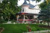
Alternate Route 66, Wilmington to Joliet
May 5, 2006
(
#
06000381
)
Illinois Route 53
between Wilmington and Joliet
41°24′16″N
88°06′27″W
/
41.404444°N 88.1075°W
/
41.404444; -88.1075
(
Alternate Route 66, Wilmington to Joliet
)
Joliet
and
Wilmington
This is the section of former
U.S. Route 66
that traveled from
Wilmington
to
Joliet
. The road mostly traverses agricultural land, but does pass the former
Joliet Army Ammunition Plant
. Most of this 15.9-mile (25.6
km) stretch has been re-designated
Illinois Route 53
. One bridge, one
overpass
, and Four concrete box
culverts
along the road are also included in the listing.
2
Beecher Mausoleum
Beecher Mausoleum
September 18, 2013
(
#
13000714
)
Jct. of IL 1 & Horner Ln.
41°20′13″N
87°37′08″W
/
41.336921°N 87.618908°W
/
41.336921; -87.618908
(
Beecher Mausoleum
)
Washington Township
3
Brandon Road Lock and Dam Historic District
Brandon Road Lock and Dam Historic District
March 10, 2004
(
#
04000163
)
1100 Brandon Road
41°30′17″N
88°06′20″W
/
41.504694°N 88.105667°W
/
41.504694; -88.105667
(
Brandon Road Lock and Dam Historic District
)
Joliet
The Brandon Road Lock and Dam is one of eight locks and dams used to control water levels of the
Illinois Waterway
. The waterway connects the
Chicago River
to the
Mississippi River
.
4
Briscoe Mounds
Briscoe Mounds
December 22, 1978
(
#
78001198
)
Front St. along the Des Plaines River
[5]
41°25′10″N
88°13′08″W
/
41.41944°N 88.21888°W
/
41.41944; -88.21888
(
Briscoe Mounds
)
Channahon
The mounds are an archeological site located along the north side of the
Des Plaines River
. Surveys and excavations from 1938 to 1964 revealed
Mississippian
pottery and bodies dating from 1200-1500 AD.
5
Chicago Sanitary and Ship Canal Historic District
Chicago Sanitary and Ship Canal Historic District
December 20, 2011
(
#
11000907
)
Illinois Waterway miles 290.0-321.7
41°38′31″N
88°03′37″W
/
41.641867°N 88.060208°W
/
41.641867; -88.060208
(
Chicago Sanitary and Ship Canal Historic District
)
Lemont
,
Romeoville
and
Lockport
part of the Illinois Waterway Navigation System Facilities
MPS
; extends from
the West Side of Chicago
through
Cook County west of Chicago
and
DuPage County
to
Lockport
6
Christ Episcopal Church
Christ Episcopal Church
August 12, 1982
(
#
82002603
)
75 West Van Buren Street
41°31′33″N
88°05′03″W
/
41.525833°N 88.084167°W
/
41.525833; -88.084167
(
Christ Episcopal Church
)
Joliet
The church was built in 1885 to serve the
Episcopalian
religious congregation. Designed by
F. S. Allen
, the congregation met in the church until 2004. It was destroyed in a 2006 fire.
[6]
7
Downtown Peotone Historic District
Downtown Peotone Historic District
November 16, 2005
(
#
05001253
)
Roughly North First Street and both sides of North Second Street, roughly bounded by the alley south of Main and north by North Street
41°20′03″N
87°47′29″W
/
41.334167°N 87.791389°W
/
41.334167; -87.791389
(
Downtown Peotone Historic District
)
Peotone
The
Illinois Central Railroad
opened in 1856 with a station in eastern Will County. The surrounding area became known as Peotone and featured a lively commercial district along the tracks. This district later expanded in response to growing use of automobiles.
8
Downtown Plainfield Historic District
Downtown Plainfield Historic District
September 18, 2013
(
#
13000719
)
Lockport bounded by Division & Main Sts.
41°36′30″N
88°12′18″W
/
41.608432°N 88.205134°W
/
41.608432; -88.205134
(
Downtown Plainfield Historic District
)
Plainfield
9
Eagle Hotel
Eagle Hotel
February 16, 1994
(
#
94000021
)
100
–
104 Water Street
41°18′28″N
88°08′51″W
/
41.307778°N 88.1475°W
/
41.307778; -88.1475
(
Eagle Hotel
)
Wilmington
Eagle Hotel opened in the late 1830s to accommodate farmers traveling to Wilmington to use the local
grist mill
. The
Chicago and Alton Railroad
and
U.S. Route 66
were later constructed near the hotel, providing further commerce. The interior was badly damaged in a 1990 fire.
10
Fitzpatrick House
Fitzpatrick House
February 9, 1984
(
#
84001170
)
Illinois Route 53
41°36′02″N
88°04′15″W
/
41.600556°N 88.070833°W
/
41.600556; -88.070833
(
Fitzpatrick House
)
Romeoville
[7]
11
Flanders House
Flanders House
November 14, 1991
(
#
91001688
)
405 West Main Street
41°36′45″N
88°12′10″W
/
41.6125°N 88.202778°W
/
41.6125; -88.202778
(
Flanders House
)
Plainfield
12
Ron George Round Barn
Ron George Round Barn
December 7, 1982
(
#
82000401
)
Northeast of Romeoville off of
U.S. Route 66
41°39′28″N
88°09′52″W
/
41.657778°N 88.164444°W
/
41.657778; -88.164444
(
Ron George Round Barn
)
Bolingbrook
Relocated in 1998 to Essington Road.
[8]
13
John Heck House
John Heck House
August 16, 1994
(
#
94000978
)
1225 South Hamilton Street
41°35′07″N
88°03′29″W
/
41.585278°N 88.058056°W
/
41.585278; -88.058056
(
John Heck House
)
Lockport
14
Jacob H. Henry House
Jacob H. Henry House
May 14, 1979
(
#
79000875
)
20 South Eastern Avenue
41°31′23″N
88°04′35″W
/
41.523056°N 88.076389°W
/
41.523056; -88.076389
(
Jacob H. Henry House
)
Joliet
15
Illinois and Michigan Canal
Illinois and Michigan Canal
October 15, 1966
(
#
66000332
)
7 miles (11
km) southwest of Joliet on
U.S. Route 6
, in
Channahon State Park
41°34′11″N
88°04′11″W
/
41.569722°N 88.069722°W
/
41.569722; -88.069722
(
Illinois and Michigan Canal
)
Joliet
16
Joliet YMCA
Joliet YMCA
February 9, 2006
(
#
06000010
)
215 North Ottawa Street
41°31′50″N
88°05′01″W
/
41.530556°N 88.083611°W
/
41.530556; -88.083611
(
Joliet YMCA
)
Joliet
17
Joliet East Side Historic District
Joliet East Side Historic District
August 15, 1980
(
#
80001418
)
Roughly bounded by Washington and Union Streets, 4th and Eastern Avenues
41°31′08″N
88°04′28″W
/
41.518889°N 88.074444°W
/
41.518889; -88.074444
(
Joliet East Side Historic District
)
Joliet
18
Joliet Municipal Airport
Joliet Municipal Airport
December 10, 1980
(
#
80001419
)
4000 West Jefferson Street
41°31′24″N
88°10′46″W
/
41.523333°N 88.179444°W
/
41.523333; -88.179444
(
Joliet Municipal Airport
)
Joliet
19
Joliet Steel Works
Joliet Steel Works
February 28, 1991
(
#
91000088
)
927 Collins Street
41°32′28″N
88°04′30″W
/
41.541111°N 88.075°W
/
41.541111; -88.075
(
Joliet Steel Works
)
Joliet
20
Joliet Township High School
Joliet Township High School
August 12, 1982
(
#
82002604
)
201 East Jefferson Street
41°31′32″N
88°04′28″W
/
41.525556°N 88.074444°W
/
41.525556; -88.074444
(
Joliet Township High School
)
Joliet
21
Louis Joliet Hotel
Louis Joliet Hotel
February 9, 1990
(
#
90000101
)
22 East Clinton Street
41°31′36″N
88°04′48″W
/
41.526667°N 88.08°W
/
41.526667; -88.08
(
Louis Joliet Hotel
)
Joliet
22
Lockport Historic District
Lockport Historic District
May 12, 1975
(
#
75000676
)
Area between 7th and 11th Streets and Canal and Washington Streets
41°35′22″N
88°03′25″W
/
41.589444°N 88.056944°W
/
41.589444; -88.056944
(
Lockport Historic District
)
Lockport
23
Lockport Lock, Dam and Power House Historic District
Lockport Lock, Dam and Power House Historic District
March 10, 2004
(
#
04000167
)
2502 Channel Drive
41°34′10″N
88°04′44″W
/
41.569444°N 88.078889°W
/
41.569444; -88.078889
(
Lockport Lock, Dam and Power House Historic District
)
Lockport
24
McGovney–Yunker Farmstead
McGovney–Yunker Farmstead
May 31, 2006
(
#
06000448
)
10824 LaPorte Road
41°31′36″N
87°52′53″W
/
41.526667°N 87.881389°W
/
41.526667; -87.881389
(
McGovney–Yunker Farmstead
)
Mokena
25
Robert Milne House
Robert Milne House
December 17, 1979
(
#
79000876
)
535 East 7th Street
41°35′22″N
88°02′57″W
/
41.589444°N 88.049167°W
/
41.589444; -88.049167
(
Robert Milne House
)
Lockport
26
Peotone Mill
Peotone Mill
March 19, 1982
(
#
82002605
)
433 West Corning Avenue
41°19′56″N
87°47′53″W
/
41.332222°N 87.798056°W
/
41.332222; -87.798056
(
Peotone Mill
)
Peotone
27
Joseph Ferris Perry House
Joseph Ferris Perry House
December 20, 2022
(
#
100008486
)
365 West Exchange St.
41°26′43″N
87°37′33″W
/
41.4454°N 87.6259°W
/
41.4454; -87.6259
(
Joseph Ferris Perry House
)
Crete
28
Plainfield Halfway House
Plainfield Halfway House
September 29, 1980
(
#
80001421
)
503 Main Street
41°36′41″N
88°12′15″W
/
41.611389°N 88.204167°W
/
41.611389; -88.204167
(
Plainfield Halfway House
)
Plainfield
29
Rubens Rialto Square Theater
Rubens Rialto Square Theater
July 24, 1978
(
#
78001199
)
102 North Chicago Street
41°31′34″N
88°04′53″W
/
41.526111°N 88.081389°W
/
41.526111; -88.081389
(
Rubens Rialto Square Theater
)
Joliet
30
Hiram B. Scutt Mansion
Hiram B. Scutt Mansion
February 5, 2003
(
#
02001760
)
206 N Broadway
41°31′37″N
88°05′18″W
/
41.526944°N 88.088333°W
/
41.526944; -88.088333
(
Hiram B. Scutt Mansion
)
Joliet
31
Small–Towle House
Small–Towle House
May 12, 2004
(
#
04000419
)
515 County Road
41°18′39″N
88°08′31″W
/
41.310833°N 88.141944°W
/
41.310833; -88.141944
(
Small–Towle House
)
Wilmington
32
Standard Oil Gasoline Station
Standard Oil Gasoline Station
November 13, 1984
(
#
84000340
)
600 West Lockport Street
41°36′29″N
88°12′20″W
/
41.608056°N 88.205556°W
/
41.608056; -88.205556
(
Standard Oil Gasoline Station
)
Plainfield
33
Stone Manor
Stone Manor
November 26, 1980
(
#
80001420
)
Southeast of Lockport
41°34′23″N
87°56′10″W
/
41.573056°N 87.936111°W
/
41.573056; -87.936111
(
Stone Manor
)
Homer Glen
34
U.S. Post Office
U.S. Post Office
August 20, 1981
(
#
81000223
)
150 North Scott Street
41°31′39″N
88°04′49″W
/
41.5275°N 88.080278°W
/
41.5275; -88.080278
(
U.S. Post Office
)
Joliet
35
Union Station
Union Station
August 1, 1978
(
#
78001200
)
50 East Jefferson Street
41°31′28″N
88°04′47″W
/
41.524444°N 88.079722°W
/
41.524444; -88.079722
(
Union Station
)
Joliet
36
Upper Bluff Historic District
Upper Bluff Historic District
June 5, 1991
(
#
91000687
)
Roughly bounded by Taylor, Center and Campbell Streets and Raynor Avenue
41°31′45″N
88°05′47″W
/
41.529167°N 88.096389°W
/
41.529167; -88.096389
(
Upper Bluff Historic District
)
Joliet
37
Will County Courthouse
Upload image
May 22, 2023
(
#
100009005
)
14 West Jefferson St.
41°31′30″N
88°04′56″W
/
41.5249°N 88.0823°W
/
41.5249; -88.0823
(
Will County Courthouse
)
Joliet
38
Will County Historical Society Headquarters
Will County Historical Society Headquarters
May 17, 1972
(
#
72000467
)
803 South State Street
41°35′21″N
88°03′17″W
/
41.589167°N 88.054722°W
/
41.589167; -88.054722
(
Will County Historical Society Headquarters
)
Lockport


.jpg)