Mitchell State Park
Park in Michigan, USA
| William Mitchell State Park | |
|---|---|
.jpg)
Clam Lake Canal
with campground on the right
|
|


Location in Michigan
Show map of Michigan

Mitchell State Park (the United States)
Show map of the United States
|
|
| Location | Cadillac , Wexford County , Michigan , United States |
| Coordinates | 44°14′17″N 85°27′08″W / 44.23806°N 85.45222°W / 44.23806; -85.45222 [2] |
| Area | 334 acres (135 ha) |
| Elevation | 1,289 feet (393 m) [2] |
| Designation | Michigan state park |
| Established | 1920 [3] |
| Named for | William W. Mitchell |
| Visitors | 155,633 (in 1996) |
| Administrator | Michigan Department of Natural Resources |
| Website | William Mitchell State Park |
William Mitchell State Park is a public recreation area covering 334 acres (135 ha) within the city limits of Cadillac in northern lower Michigan . The state park is located between Lake Mitchell and Lake Cadillac . The historic Clam Lake Canal , approximately one-third of a mile in length, connects the two lakes and runs directly through the park. [4] Dug in 1873 at the direction of city father George A. Mitchell , the canal allowed felled trees to be floated from Lake Mitchell to lumber mills on Lake Cadillac. [5]
History
The park bears the name of William W. Mitchell, who during the 1890s operated sawmills in the area as co-owner of the Cobbs and Mitchell Mill No. 1, [6] and who was a nephew of city founder George Mitchell. [7] Under the name Cadillac State Park, it was among 13 parks established in 1920 following the creation of the Michigan State Parks Commission a year earlier. [8] [9] The park's "prime real estate" was donated by Mitchell's widow, Ellen, who requested the park be named in her late husband's honor. [6]
Features
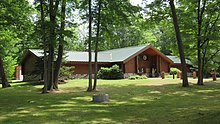
The park is home to Carl T. Johnson Hunting and Fishing Center which documents the history of hunting and fishing, offers seminars, workshops and audio-visual presentations, and includes an exhibit hall which displays local wildlife species. [10]
Activities and amenities
The park offers a campground with 221 sites, cabins, two boat launches, playground, beach, picnicking facilities, and fishing for perch , walleye , panfish , and bass . The 2.5-mile (4.0 km) Heritage Nature Trail runs through a woodland and marsh environment. The trail, mostly a woodchip path with a series of bridges and boardwalks, provides a study area supporting a variety of plants and wildlife. Winter activities include snowmobiling, ice fishing, snowshoeing, and cross-country skiing. [4]
Images
-
 Johnson Hunting and Fishing Center
 -
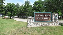 Main entrance park signage
 -
 Clam Lake Canal and campground
 -
 Beachfront along Lake Mitchell

.jpg)
.jpg)
.jpg)
References
- ↑ "Mitchell State Park" . IUCN . Retrieved May 10, 2020 .
- 1 2 "William Mitchell State Park" . Geographic Names Information System . United States Geological Survey , United States Department of the Interior .
- ↑ "When were Michigan state parks and recreation areas established?" (PDF) . Michigan Department of Natural Resources . Retrieved May 10, 2020 .
- 1 2 "Mitchell State Park" . Michigan Department of Natural Resources . Retrieved March 7, 2018 .
- ↑ "Lake Mitchell Facts & History" . Lake Mitchell Improvement Board . Retrieved March 7, 2018 .
- 1 2 "Who's who behind Michigan's named state parks". Michigan History Magazine . Historical Society of Michigan. March 1, 2016.
- ↑ Walter Romig (1986). Michigan Place Names . Detroit, Mich.: Wayne State University Press. p. 604. ISBN 081431838X . Retrieved March 7, 2018 .
- ↑ "Michigan DNR celebrates 100 years of state parks" (PDF) . Michigan Department of Natural Resources. pp. 10–11 . Retrieved May 10, 2020 .
- ↑ Albert Stoll, Jr. (ed.). "Biennial Report of the Department of Conservation of the State of Michigan 1921–1922" . p. 228 . Retrieved May 10, 2020 .
- ↑ "Carl T. Johnson Hunting and Fishing Center" . Michigan Department of Natural Resources . Retrieved March 7, 2018 .
External links
- Mitchell State Park Michigan Department of Natural Resources
- Mitchell State Park Map Michigan Michigan Department of Natural Resources

|
Authority control
: National
|
|---|